October 2021. In my last story posted here I described my ecological explorations in the San Francisco Bay area in June during a writing residency at The Mesa Refuge in Point Reyes Station, right on the San Andreas Fault at the south end of Tomales Bay. I was gathering information and experiences for essays about the Golden Gate Biosphere Region, part of an international network of biosphere reserves designated by UNESCO, the United Nations Educational, Scientific and Cultural Organization, which now includes 714 sites in 129 countries. Biosphere reserves in this global network are living laboratories for understanding and improving the often strained and unsustainable relationship between humans and nature. They are located in places of high ecological importance and value for biodiversity conservation, representing the ecological and cultural diversity of the biosphere. The lessons learned in one biosphere reserve often apply elsewhere. The biosphere reserve model has been a touchstone for me in my international ecological consulting work, and I’ve been fortunate to work in 35 biosphere reserves in 17 countries so far.
In October I spent another few weeks in California, this time in the Santa Barbara and Channel Islands bioregion. I was invited for two weeks as a La Kretz Visiting Scholar at the Sedgwick Reserve, one of 41 natural reserves in a network managed by the University of California system, and one of the seven overseen by the University of California, Santa Barbara. My visit there, like that to The Mesa Refuge, had been postponed for about a year due to the coronavirus pandemic. With the pandemic seeming to taper off, it finally happened! After my time at Sedgwick, I spent another week as a visiting scientist at the UCSB Santa Cruz Island Reserve, located on the largest of the Channel Islands.
In this story I want to connect these two expeditions to the western edge of our continent and summarize my purpose for both. I also want to provide some details about the Sedgwick Reserve, as I did in the previous story about my residency at The Mesa Refuge. My time in southern California was such a rich experience that I can’t summarize it all here; stories to follow will focus on the amazing ecology and biogeography of Santa Cruz Island, and also the opportunity here in this ecoregion to reconstruct a non-Western worldview that may reach back to the first humans to inhabit the North American Pacific Coast more than 13,000 years ago.
My purpose for this second cross-continent trip of 2021 was parallel to my reconnaissance of the Golden Gate Biosphere Region in June. I wanted to begin to explore the Channel Islands Biosphere Reserve, the second UNESCO biosphere reserve in California: I planned to do some background research; talk to scientists, managers, and other people involved in conservation there; experience the ecosystems of the place firsthand; and sketch out some essays that may eventually turn into a sequel to my book about Oregon’s Cascade Head Biosphere Reserve (The View from Cascade Head: Lessons for the Biosphere from the Oregon Coast, Oregon State University Press, 2020).
In my book about Cascade Head, I summarized the three main lessons I saw there as:
- People make a difference. Their stories are unequivocal in showing the importance of inspired, value-based, individual action.
- Ecological mysteries still abound, despite all the knowledge we’ve gained, and this means that the need for research to inform sustainable ecological management is a never-ending task.
- How we think about our place in nature—our worldview—matters. Worldviews shape our individual and collective behavior and our effects on the biosphere that sustains us, in potentially positive and sometimes negative ways.
In the Golden Gate bioregion, this conceptual framework of “lessons” worked well as a lens through which to examine the situation there, and I wanted to use the same framework to compare and contrast what I found in the Santa Barbara-Channel Islands bioregion. I was satisfied again with how well these three lessons were illustrated in the Channel Islands Biosphere Reserve.
_______
The Channel Islands Biosphere Reserve was one of the first 29 UNESCO biosphere reserves to be designated by the United States in 1976—as was Cascade Head in Oregon. The explanation for its inclusion in the initial list is probably that it was known as a unique and important area for ecological and evolutionary research, with a track-record of such research reaching back more than forty years at the time. In its initial designation, the biosphere reserve only included the Channel Islands National Monument, which consisted only of Anacapa Island and Santa Barbara Island; it was expanded in 1980 to include the then-created Channel Islands National Park, encompassing the other three northern islands (Santa Cruz, Santa Rosa, and San Miguel), and also the newly created (in 1980) Channel Islands National Marine Sanctuary. In the Periodic Review written for UNESCO in 2016, the biosphere reserve proposed expanding its area of engagement beyond the offshore islands to federal, state, and local agencies and stakeholders on the California mainland in Ventura and Santa Barbara counties. Many of these mainland stakeholders were already engaged in management issues with the biosphere reserve through the diverse advisory committee of the national marine sanctuary.
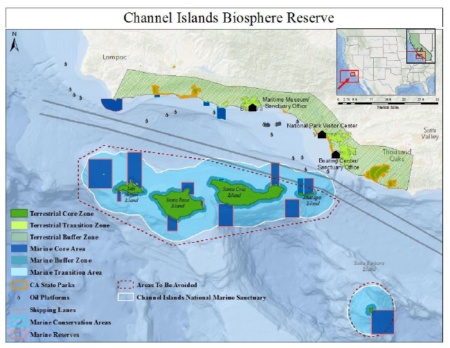
Compared to relatively tiny Cascade Head, and even to the giant Golden Gate Biosphere Reserve, established only in 1988, the Channel Islands region is a unique place to create a “laboratory” for examining the human-nature relationship. The population of southern California is nearly 20 million—the second-largest urban agglomeration in the United States. The two California counties on the mainland of the biosphere reserve, Santa Barbara and Ventura counties, have a combined population of over a million people—more than any of six U.S. states. The ports of Los Angeles and Long Beach are the most important and busiest on the West Coast for global trade from Asia, and are currently overwhelmed with “supply chain” issues—delaying everything from computer chips for cars to all the other cheap products from China we’ve come to take for granted. Shipping lanes a mile wide inbound and outbound slice through the biosphere reserve between the Channel Islands and the Santa Barbara and Ventura coast to these ports, through rich feeding grounds for dolphins, blue whales, and humpback whales, past offshore oil platforms in the Santa Barbara channel that are still pumping oil to satisfy our fossil fuel addiction more than half a century after the 1969 Santa Barbara oil spill, an event credited with the origin of the first “Earth Day” in 1970 and for stimulating landmark reforms of U.S. environmental law. The crude bunker oil burned by these ships is a major contributor to air pollution in southern California. One could look at this history and the current facts and wonder whether we have learned anything at all about a sustainable human-nature relationship here in the past fifty years.
After my return from California, the Washington Post had two stories that resonated about the Channel Islands bioregion. One said that a “record” 81 container ships were waiting offshore to unload at the ports of Los Angeles and Long Beach. Another article, about the current inflation rates in the US, quoted Connor Lamb, a representative from the Pittsburgh area in Pennsylvania, a Democrat in a “purple” bellwether district, lamenting that “inflation” and “supply chain issues” may mean that he has to pay more this year for his children’s Christmas presents this year. Uh… excuse me, Connor… It was only days since the end of the Glasgow Climate Summit, which was an important event regarding the human-nature relationship on our planet… and the cost of Christmas crap imported from China through a completely unecological and unsustainable global economic system is at the top of your list as an American politician? It makes me wonder whether our current political system has any ability at all to address the existential ecological issues of our time. But that—addressing the existential issues in the human-nature relationship—is what biosphere reserves are supposed to be helping us to figure out. I think that the Channel Islands Biosphere Reserve, and all the others, are the social and ecological “laboratories” we need to get on with this existential business.
_______
With a promise to continue probing into the issues of a biosphere reserve on the edge of the Los Angeles metro area, I want to take a step into “deep time” to link this place with my “on the edge of the continent” experience at Point Reyes. I made the slipping of tectonic plates a focus of, and metaphor in, my previous story, “Ecological Explorations at the Edge of a Continent,” and I now want to connect the geology behind that story with this one.
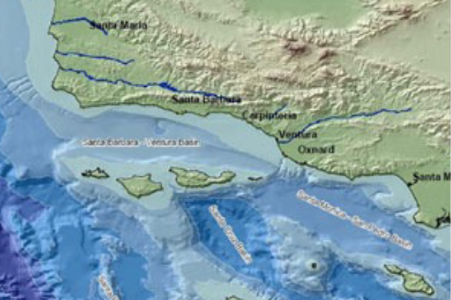
The boundary between the Pacific and the North American plates that was so clearly visible as the San Andreas Fault ran under the Olema Valley and Tomales Bay just outside my writing-shed window at The Mesa Reserve in northern California gets more muddled in what geologists call the “Transverse Ranges” near Santa Barbara. (I think of it as “Sideways” country, after the 2004 award-winning movie of that name, which follows two forty-something men on a brief road trip to the Santa Ynez Valley wine country near the Sedgwick Reserve. As the two friends try to find their footing in life and foresee their futures, the twists and turns of plot fit right in with the twisted and sideways-turned geological setting, in my mind at least.) As I mentioned in my previous story, the granite that forms the outer point of the Point Reyes Peninsula matches granite found in the Temblor Range, one of the Transverse Ranges not far north of Sedgwick. It was transported around 300 miles northward in earthquake-increments over about twenty million years or so. But, it seems that around four million years ago the southern end of the San Andreas Fault shifted east, opening up the Gulf of California between the Baja Peninsula and the Mexican mainland. That created a westward bend in the fault in the Los Angeles-Santa Barbara area, and a problem for the smooth northwest-trending slippage of the Pacific Plate—a kink that caused it to throw up the Transverse Ranges in a tectonic tantrum of sorts. The northern Channel Islands, now around twenty miles offshore from this coast, are the tops of one of the southernmost of these ranges, now mostly underwater. The bend in the fault created a bend in the coastline called the California Bight, where, at Point Conception, the northwest orientation of the coast that reaches all the way to Canada suddenly turns into an east-west coast, and the south-flowing California Current that has carried cold water all the way from the North Pacific turns offshore, allowing a countercurrent of warmer water to flow north along the southern California coast. The bend in the mainland ranges and coastline affects climate and ocean currents so as to create a biogeographic divide—a shift in both terrestrial and marine ecosystems—at this point on the North American coast.
_______
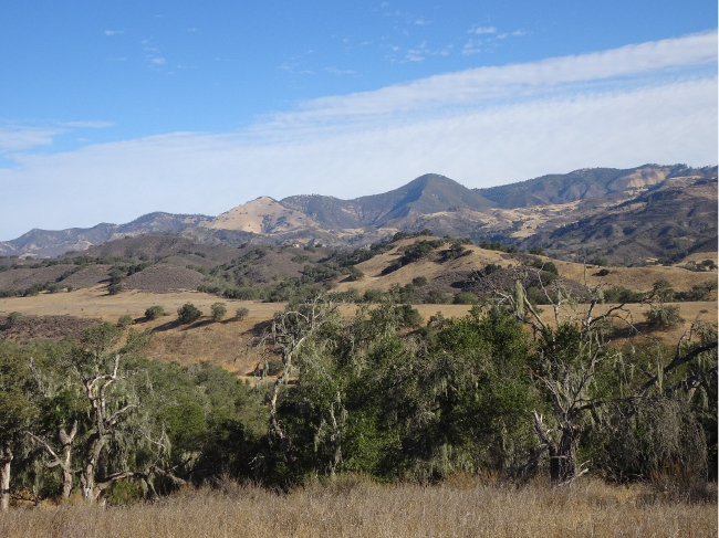
One of my main delights as an ecologist is to see and touch a new ecosystem I haven’t explored before. My scientific-pattern-seeking eye and mind takes it in, of course, but so does my aesthetic and poetic imagination. The Sedgwick Reserve didn’t disappoint, and I immediately settled in to enjoy the magic of this unique place in our biosphere. The approximately nine-square-mile reserve reaches north up the Figueroa, Lisque, and Windmill valleys from the field station headquarters. The land became a part of the California Natural Reserve System in 1997, when sculptor and rancher Francis “Duke” Sedgwick and his wife bequeathed most of their Sedgwick Ranch property to the University of California for interdisciplinary teaching and research.
On my first afternoon after settling into the simple but comfortable visitor’s apartment at the reserve headquarters, I stepped out of the west door to start an afternoon run and was greeted by a tarantula almost as big as my hand on the doorstep. They were on the move; it was tarantula mating season, I was told. I watched and waited, fascinated, until the big spider moved on. Ah! The eight-legged walk of these creatures is a delicate, seamless flow, so unlike that of any mammal or bird we are used to seeing it is spellbinding. Off this one went, a female I think, ignoring me completely, to her unknown arachnid assignation.
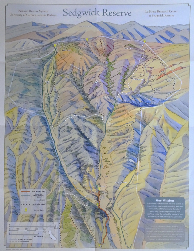
I had met Kate McCurdy, the director of the reserve, on my first afternoon there. After our greetings and formalities, she said “You look like a runner…” and I said “Yeah, I love to run, and it looks like you have a great network of roads and trails here!” I’d seen the reserve map, and was eager to explore the place on foot.
“Yeah, well…” Kate said, “I would recommend that you run out toward the main road from here. We’ve had a bunch of photos of mountain lions on our wildlife cameras… There was a female with two juveniles just up on the…” She mentioned some place I wasn’t yet familiar with.
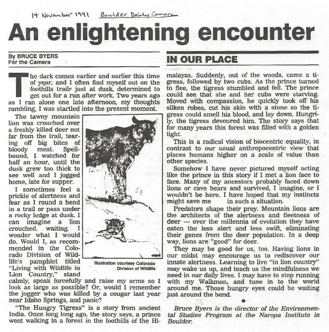
That reminded me of my encounter with a mountain lion on a trail on the edge of Boulder, Colorado, where I then lived, more than thirty years ago. I wrote about that in my monthly column for the Boulder Daily Camera newspaper, titling the piece “An Enlightening Encounter,” and I sent Kate a link to that story from then (see a copy at the end of this story). Teasing my Boulder readers a bit I guess, I concluded then that if I die by being eaten by a mountain lion, it will at least be an ecologically logical way to go.
For the rest of my two weeks at Sedgwick I ran the back roads and trails every day, ignoring Kate’s advice. Unfortunately, I never saw a lion, but I saw plenty of mule deer, their probable prey. Only once, in the dust of a road, did I see lion tracks, as big as my palm, pug marks so clear. That secondhand encounter made me happy, confirming the fact that lions were here, probably with eyes on me at that very moment, watching me run (and probably deciding a skinny human didn’t look nearly as tasty as a fat deer). Seeing the fresh tracks tweaked my alertness and accentuated my attentiveness to this place. I’m sorry I never saw them though. I’m grateful I didn’t get eaten by one at Sedgwick—but if I had, I would have a certain level of fame that I will never have no matter what I do in life from here on out.
I also knew there were black bears here. A big tower of black bear shit with telltale bits of acorn shell in it appeared one night a few yards from where I parked in front of my apartment. The bears are down from the mountains above, happy with the valley oak acorn crop. I never saw a bear either, unfortunately. But I saw many more scat piles on my runs and hikes. Sadly, the last grizzly bear in California was killed in 1922 near Yosemite National Park. (Griz still stands proudly on the state flag of the “Bear Flag” state). I say “sadly” sincerely, although if grizzlies were roaming the Sedgwick Reserve now, as they once did abundantly, my alertness to an “enlightening encounter” would have increased by an order of magnitude beyond what I had for the relatively benign and predictable mountain “kitties” and black bears I knew were there.
I saw a coyote, only once, loping off across the oak savanna. But I heard their songs many nights, sometimes not far from my bedroom window. Oh! That magical music of the “defiant songdog of the west” (subtitle of a 1988 book about coyotes by Francois Leydet). I miss their singing so much when I’m not in places where I can hear it often.
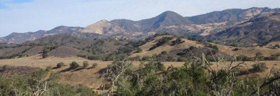
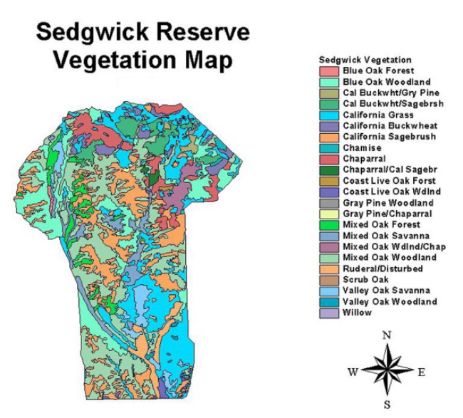
The geology of the Sedgwick Reserve affects its topography and soils, which of course affect its vegetation. The Little Pine Fault, a minor branch of the network of faults that translate the motion of the San Andreas Fault in the “sideways” Transverse Ranges area, crosses the reserve from southeast to northwest. The south-tending valleys and ridges southwest of the fault support oak savanna and woodlands, while the steep canyons northeast of the fault expose serpentine and rocky soils favoring chaparral, coast live oak forest, and gray pines. The vegetation map of the reserve—which is shaped a bit like a T-shirt—shows this pattern well; tracing the fault from the left “armpit” to the right “neckline,” the colors of the shirt indicate the dominance of the drier plant communities (see map below).
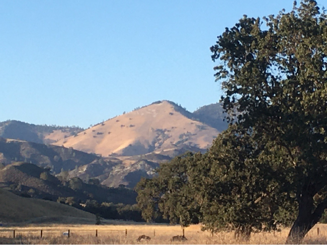
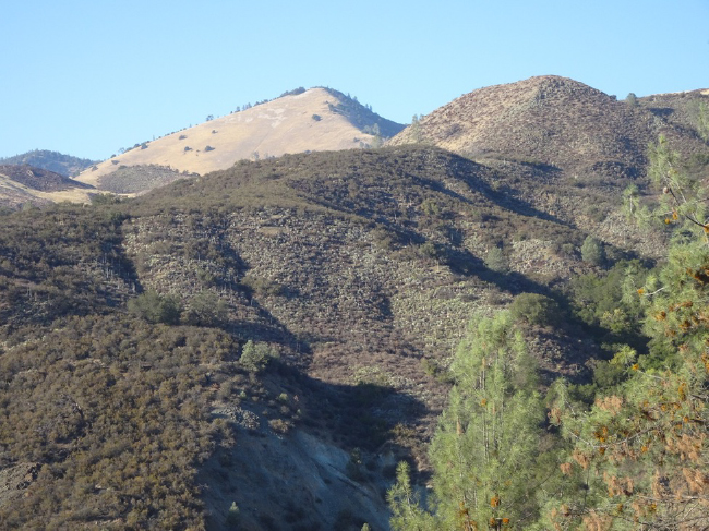
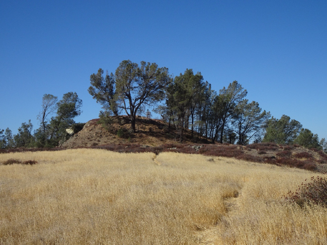
On a high rocky ridge at the northern edge of the reserve, looking up to Grass Mountain and Zaca Peak in the Los Padres National Forest, gray pines crown a crest called “Cloud’s Rest.” Frank Davis, a UCSB faculty member and director of the La Kretz Research Center at Sedgwick Reserve, took me there on an orientation tour on my first day. We walked up the ridge to the grove of old, airy pines in a blasting north wind. This species, Pinus sabiniana, is found in the “California foothills” ecosystem—seasonally dry habitats at a certain elevation, from about here at Sedgwick in the south, and ringing the California Central Valley both south and north. The large seeds of this pine are harvested and dispersed by scrub jays and acorn woodpeckers, and were once an important food of California Indians. The cones are impressive, large and heavy, with wickedly sharp spikes on their scales. Why the thorns, the ecologist in me wondered? Must be the result of a coevolutionary arms race with some seed predator, current or now-extinct, I guess… but once the cone scales open, the spines probably wouldn’t deter the jays or woodpeckers, and the pines may “want” them to disperse their seeds.
Each of the four species of oak found at Sedgwick—valley oak (Quercus lobata), blue oak (Quercus douglasii), coast live oak (Quercus agrifolia), and California scrub oak (Quercus berberidifolia)—has a unique ecological niche, and also what I like to think of as a “personality.” (Thinking of plants as having both ecological niches and personalities works for me because I’m an observer who looks through both a scientific and an emotional “eye.”)
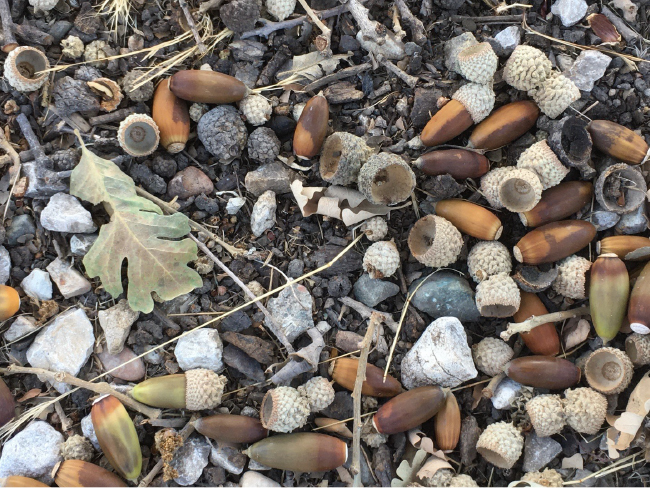
The ancient, huge, noble valley oaks at Sedgwick were producing an abundant crop of acorns, luring the bears and keeping the extended families of acorn woodpeckers busy.
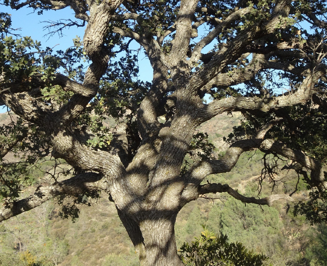
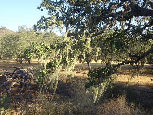
I was fascinated by the blue oaks of the reserve. Blue oak, scientifically named Quercus douglasii in honor of David Douglas, a pioneering Scots botanist of the Pacific Northwest (from whom the common name of “Douglas-fir” comes), is a drought-tolerant, deciduous oak found only in the Coast Ranges and Sierran foothills of California, and often in association with gray pine. Their common growth form of multiple, contorted trunks and branches made them the most suggestive—to my druidic imagination, at least—of sprites, spirits, goddesses…
What especially caught my attention was that these oaks, more than the other species, were often hung with long strands of something that looked like the “Spanish moss” of the southeastern United States. This wasn’t a northward-straying bromeliad like Spanish moss, but a native symbiotic lichen, Ramalina menziesii, the “lace lichen.” This species is the officially designated “state lichen” of California, apparently the first lichen ever honored with such a designation. (For another obscure fact, this lichen was named after Archibald Menzies, another Scots botanist, who accompanied the Vancouver Expedition (1791-1795), and after whom Douglas-fir (Pseudotsuga menziesii) is scientifically named. What’s up with these Scottish botanists in the Pacific Northwest?).
Seeing this symbiotic relationship of trees and lichens echoed what I learned about the potential importance of lichens in ecological communities from my 2019 visiting scientist residency at the U.S. Forest Service’s H.J. Andrews Experimental Forest in the Oregon Cascades. Research there has shown that the nitrogen-fixing lichen, Loberia oregana, found in the canopy of old-growth Douglas-fir forests, is the major contributor of nitrogen to the ecosystem; the weight of Loberia is estimated to be five percent of the weight of the tree’s own foliage. For Ramelina, a study titled “The Influence of Epiphytic Lichens on the Nutrient Cycling of an Oak Woodland” (Knops, et al., 1997) has shown that this lichen harvests nutrient elements such as nitrogen and phosphorus from the air, and then passes them to the soil to feed the local nutrient cycles and nourish the blue oaks that hosted them.
Decades of research at Sedgwick have contributed to our understanding of the ecology of these oaks: their reproduction, recruitment, and survival over centuries (long-lived oaks provide a long record) here. Centuries of human change, changing fire regimes, changing land use, and changing climate—to describe the situation as complex is almost an understatement. That ecological knowledge is important for foreseeing and potentially managing the future trajectory of these ecosystems—thus the value of natural reserves like Sedgwick to the society and economy of this bioregion.
On my second day at Sedgwick, with fierce north winds still blowing, I drove the fifteen minutes into Santa Ynez to stock up on groceries for my stay at the El Rancho Market. I passed the giant casino of the Santa Ynez Band of Chumash Indians, the only federally registered tribe of the widespread Chumash group of tribes that once occupied a large area the mainland, coast, and islands from San Luis Obispo to Santa Monica. When I came out to my car after shopping, I noticed a telltale plume of smoke over the Santa Ynez Mountains to the south. Fire trucks blasted through the intersection as I was driving back to Sedgwick, responding to the very beginning of the Alisal Fire, the first major wildfire of the season in southern California. On my runs on Sedgwick trails and roads I watched its smoke plumes for the next week; fortunately for Sedgwick and for me, it was downwind. But the Alisal Fire was a reminder that fire is an ecological partner and “stakeholder” in this ecosystem, and we humans need to give it a seat at the table as we plan for the future.
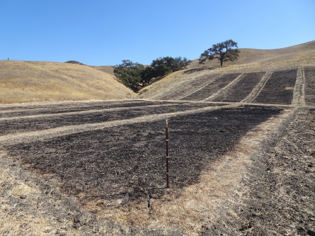
Sedgwick Reserve is contributing to the ecological dialogue with fire here through its research. On our initial reconnaissance, Frank Davis also took me to see an area of experimental prescribed burns designed to investigate the effect of grazing on fire intensity in the grassland habitats of the area. The result is no surprise, really: grazing can reduce the density of biomass that can carry a fire. But… the fire ecology of this whole bioregion is so complicated and so intertwined with the peri-urban-sprawl economy of ranchettes and vineyards that people have created here, as to be almost impossible to understand scientifically, much less manage-for politically. Consider: just to the west of the Sedgwick Reserve is a development of mega-expensive equestrian- and second-home ranchettes, and those landowners don’t want fire anywhere near their properties… but the longer they keep it out, the higher the risk and intensity of the next inevitable fire becomes.
_______
As promised above, this initial story about my October exploration of the Channel Islands ecoregion will be followed with another post about Santa Cruz Island, one of the islands in what has been called “California’s Galapagos. And also promised, my thoughts about the tantalizing opportunity afforded here to understand and perhaps revitalize an indigenous American worldview, that of the Chumash culture that the Spanish found thriving upon their first contact with it in 1542 AD. New research showing that the Channel Islands may have been one of the first human settlements in North America more than 13,000 years ago provokes further interest in the possibility that this worldview may reach back in time to our hunter-gatherer ancestors, and predate the worldviews of the European cultures that later colonized North America and have come to dominate the planet—and put our species in peril.
For related stories see:
- Ecological Explorations at the Edge of the Continent, June 2021.
- Explorations in Oregon’s Andrews Experimental Forest, December 2019.
- More Fun and Philosophy in the Andrews Experimental Forest, February 2020.
Sources and other links:
- Mesa Refuge
- UNESCO Man and the Biosphere (MAB) Programme
- Sedgwick Reserve
- University of California Natural Reserve System
- Santa Cruz Island Reserve
- The View from Cascade Head: Lessons for the Biosphere from the Oregon Coast (Oregon State University Press, 2020)
- Channel Islands National Park
- History of Channel Islands National Park
- Channel Islands National Marine Sanctuary
- Transverse Ranges
- “Sideways” movie
- Map of Topography of the Channel Islands and Transverse Ranges
- Leydet, Francois. 1988. The Coyote: Defiant Songdog of the West.
- Gray Pine (Pinus sabiniana)
- Valley Oak (Quercus lobata)
- Blue Oak (Quercus douglasii)
- Coast Live Oak (Quercus agrifolia)
- California Scrub Oak (Quercus berberidifolia)
- Lace Lichen (Ramelina menziesii)
- “The Influence of Epiphytic Lichens on the Nutrient Cycling of an Oak Woodland” (Knops, et al., 1997)
- Byers, Bruce A. 2019. “Ten Questions in the Andrews Forest.” The Forest Log, Spring Creek Project, Oregon State University.



December 12, 2021 12:10 am
Thank you for the journey. I can hardly wait to see it again with fresh eyes.