
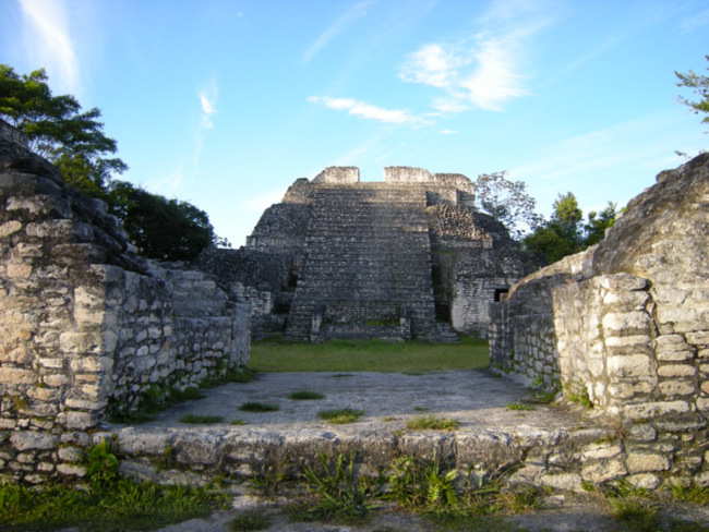
March 2013. On our second night in Belize we camped at Caracol, now the ruins of what once was the largest and most powerful Mayan city in what is now that country. In the 7th Century AD – or better called the Common Era (CE), a less euro- and christiano-centric designation of centuries than “Anno Domini” – Caracol defeated the premier Mayan city-state of Tikal not too far north, now in Guatemala, and dominated it for 135 years. Today the Caracol site is remote and hard to reach, a drive of several hours on rough roads south from the nearest pavement at San Ignacio, over the Mountain Pine Ridge and across the Guacamallo River into the Chiquibul Forest Reserve. We were here with the head of the Institute of Archeology of Belize, Dr. Jaime Awe, on a weekend trip organized by the U.S. Embassy. We pitched our tent among others at the research camp on the edge of the ruins.
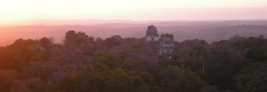
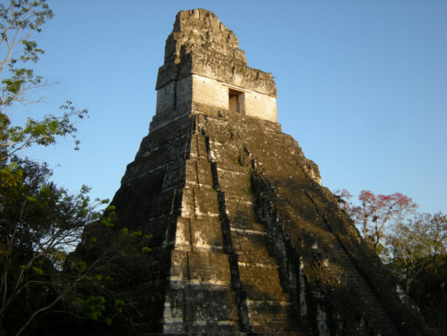
Upper section of the Canaa Pyramid, Caracol
After dinner, a small group gravitated to a big campfire. But the March moon was full, and lured a couple of us off toward the plaza in front of the largest temple pyramid at Caracol, called Canaa – Mayan for “Sky Place.” Canaa is believed to have been completed around 800 CE, not long before classical Mayan civilization began to collapse, but it is still the tallest and largest man-made structure in Belize, rising 136 feet above the plaza below. We walked mostly by moonlight, but our senses were on high alert, and sometimes in the moonshade of the big trees we turned on our headlamps, giving us only false confidence that we could have seen a deadly fer-de-lance slithering across our path, or a jaguar lurking in the shadows. When we reached the plaza, we sat on the steps of the pyramid facing Canaa to absorb the scene. Night insects called from the trees, and as we sat on the cool stone steps a haunting voice called from somewhere up on the steps of Canaa. “Who are YOOUU?” it asked. “Who are YOOUU?” “Who are YOOUU?”
We were startled at first, but the voice had the quality of birds of the nightjar family, the Caprimulgidae, to which the whip-poor-wills and poor-wills that call in North America on summer nights belong. I tried to imitate the call, whistling back as best I could: “Who are YOOUU?” And from the steps of Canaa came the echoing response: “Who are YOOUU?” We questioned back and forth for a long time, and it began to feel a little eerie, like I was talking to a Mayan spirit – maybe a guardian spirit of this place, where we were outsiders in time and space. The encounter seemed pure magical realism at the moment, but walking back to the fire circle my flashlight caught red eyeshine coming from the ground, which suggested that I had probably been conversing with a common pauraque, Nyctidromus albicollis.
Caracol once was a thriving metropolis, sprawling over 65 square miles, and with a population estimated at over 140,000 – more than one-third of the total current population of Belize. Before its collapse in the 9th century of the Common Era, the Classic Maya civilization of the area had an estimated population of four million people.
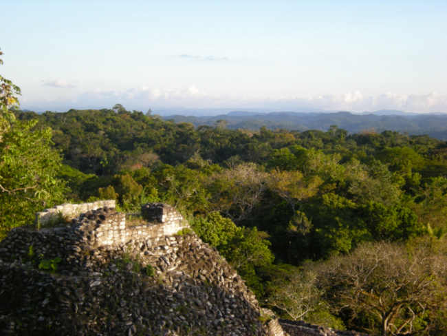
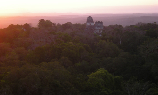
View over the Maya Forest from the top of Canaa Pyramid, Caracol
The next morning, awakened early by the roaring of howler monkeys, we climbed Canaa again, and watched the day spread over the ocean of forest, steep valleys and ridges rolling away to the north and east as far as the eye could see. According to Jaime Awe, recent research using lidar (“light radar”) – which uses laser light to look through the canopy of trees to see what is on the ground underneath – has revealed that terraces covered many of the slopes now buried in forest. According to archeologists Arlen and Diane Chase and landscape ecologist John Weishampel of the University of Central Florida, “LiDAR was initially applied to the site of Caracol, Belize in April 2009 and yielded a 200 sq km Digital Elevation Model that, for the first time, provided a complete view of how the archaeological remains from a single Maya site – its monumental architecture, roads, residential settlement, and agricultural terraces – were distributed over the landscape. With the detailed information that can be extracted from this technology, LiDAR is significantly changing our perceptions of ancient Maya civilization by demonstrating both its pervasive anthropogenic landscapes and the scale of its urban settlements.”
In the year 800 CE, at the height of Caracol’s power, our view from the top of Canaa would probably have been of an agricultural landscape: mostly crop fields, many terraced on hill slopes, and scattered villages, with only small patches of forest. It was a human-dominated landscape, probably not unlike that in many parts of Central America today. Not to mention Iowa, Illinois, Indiana, Nebraska, etcetera – most of the U.S. midwest, which is almost all agriculture, with not even any “villages” left in the landscape. The regenerated forest here has buried that once human-dominated landscape again. We watched noisy groups of keel-billed toucans, red-lored parrots, and Montezuma oropendulas squabbling through the canopy of tall trees at eye-level from the tops of the ancient temple pyramids.
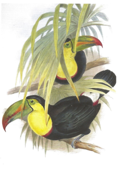
Keel-billed toucan (Ramphastos sulfuratus), hand-colored lithograph by John Gould, 1854
The Caracol archeological reserve borders Chiquibul National Park to the north and south, and the Chiquibul Forest Reserve to the east. The forest landscape farther to the north is protected by the Mountain Pine Ridge and Vaca Forest Reserves. To the east, the Maya Mountain Forest Reserve and Cockscomb Basin Wildlife Sanctuary conserve more forest. To the northwest, in Guatemala, the Maya Biosphere Reserve, which includes Tikal National Park, tries to conserve an area of forest larger than Yellowstone National Park.
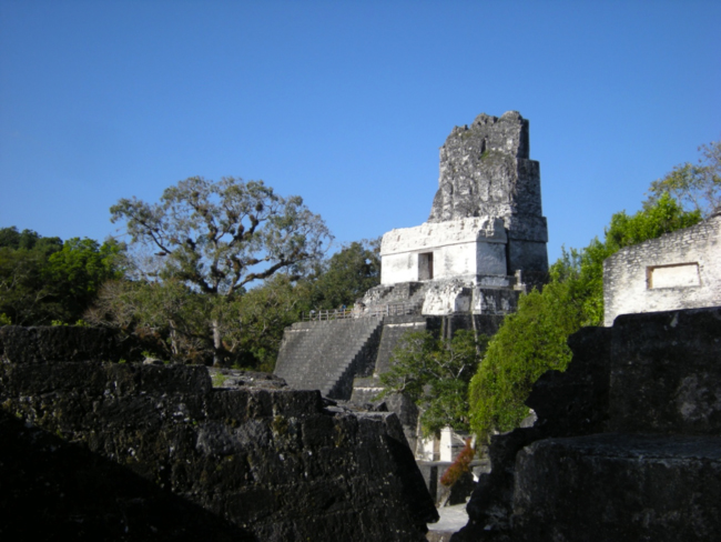
A few days after camping at Caracol we crossed into Guatemala and visited the Tikal archeological site, the ruins of a more famous Classic Mayan city. Tikal sprawled over more than 20 square miles, and had a population of probably 100,000 people, based on the extent of agricultural terracing and the production it could have sustained. In 682 CE – we know this exact date because of the sophistication of the Mayan calendar – a ruler named Jasaw Chan K’awiil (previously called Ah Cacao, or “Lord Cocoa”) began to restore Tikal’s power. He built the Temple of the Great Jaguar on the Gran Plaza, and was buried in a tomb at its base. But by around 900 A.D., Tikal had collapsed as a Classic Maya city.
Temple I, the Temple of the Great Jaguar, Tikal
If you stand at the midpoint between the Pyramid of the Great Jaguar and the Pyramid of the Masks that faces it across the Gran Plaza and clap your hands, you hear a sharp “chirp!” – the sound of the clap echoing from the steps of both pyramids at exactly the same time. They say it sounds like the call of the resplendent quetzal (Pharomachrus mocinno), a bird sacred to the Maya, whose long, green iridescent tail feathers were used for elite adornment and in rituals. Tik’al, in Mayan, means “the place of voices” – quetzal voices.
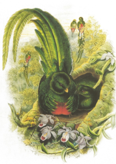
Resplendent quetzal (Pharomachrus mocinno), by John Gould, 1854
One morning we rose in the dark to walk to Temple Pyramid IV, climb it, and watch the sunrise. Looking for coffee in the dark, our headlamps picked up pink eyeshine in the small swimming pool of the Tikal Inn, where we were staying on the edge of the archaeological site inside the Tikal National Park. A small crocodile had wandered over during the night from a nearby pond, one of the ancient Mayan water storage reservoirs, and was enjoying the chlorinated pool.
As we walked through the dark forest toward Temple IV, groups of howler monkeys were roaring from several directions – the “howling” is more like a breathy roaring, like I imagine the sound of dragons shooting flames from their mouths, with a mix of elk-bugle pants and whale-song notes. We hoped the fer-de-lance snakes were scared off the dark road by our footsteps. We assumed that somewhere along the trail a jaguar was watching us pass. The Gran Plaza, with its quetzal-voice echoes, was flooded with moonlight. Venus was rising to the south of the steep steps of the Temple of the Great Jaguar.
When we finally reached Temple IV, we climbed to the east-facing steps under the roof comb in the dawnlight, and sat in meditative silence. The sun rose, silhouetting Temples I and II to the east. It wasn’t long before red-lored parrots began their noisy conversations, and the spell was broken.
Temples I and II from Temple IV at sunrise
We descended, and wandered slowly back to breakfast, entranced by the place and the day. Along the trail, ocellated turkeys and coatimundi troops foraged, tame and seemingly oblivious to us. Spider monkeys dangled by their tails from branches, picking fruit in the morning sun. This animal- and spirit-filled Maya Forest felt like a peaceable kingdom, and we felt like plain members of this morning community.
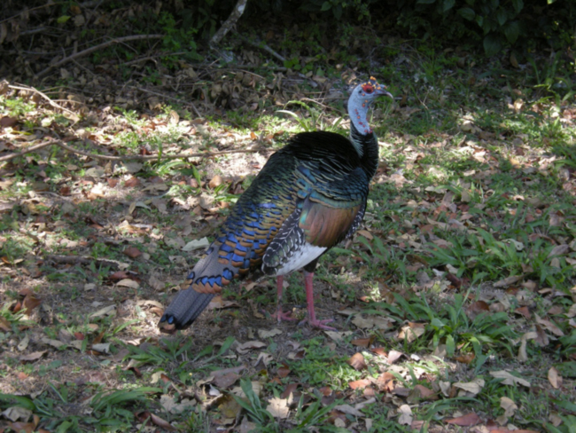
Ocellated turkey (Meleagris ocellata), Tikal
But walking back to breakfast, I thought again of the crocodile in the swimming pool. And I was reminded of a 2007 article by Webster, et al., that used an innovative technique to unravel the climate history of this area – analysis of the deposition of stalagmites in the limestone caves of the region. “The Maya civilization peaked in population density and socioeconomic complexity during the Classic period extending from A.D. 25 to 900, but it declined abruptly over the years from A.D. 750 and 900. The stalagmite record indicates that a series of droughts, which collectively form the most prolonged dry interval in the 3300-year record, lasted from A.D. 700 to 1135 and thus coincided with the collapse of the Maya civilization.”
Water was always a limiting resource for the Classic Maya cities such as Tikal and Caracol, situated on porous limestone highlands where precipitation drained rapidly underground and did not persist on the surface in lakes and rivers during the dry season. Complicated systems for retaining and storing water were developed by these city-states, and they may have been an impetus for the concentration of power in an elite class that could organize this system – a functional argument for the concentration of political and economic power to manage water similar to that proposed for the rise of ancient civilizations in Mesopotamia. These water-supply systems, dominated by a hereditary political and religious elite, were apparently very fragile. Climate variability, even before the era of human-caused climate change, could drive them beyond carrying capacity, beyond sustainability, to collapse.
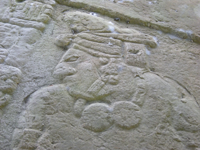
Bas-relief carving of a Mayan ruler, Caracol
Michael Coe, one of the most knowledgeable scholars of the ancient Maya, wrote in Breaking the Maya Code that “Maya civilization, which reached its peak of achievement in the eighth century, must have contained the seeds of its own downfall. When civilizations collapse, there is not one probable cause, but many. Certainly, Maya population densities had passed beyond the ‘carrying capacity’ of the environment: there is abundant evidence for erosion and environmental degradation, greatly increased internecine warfare, and near universal acts of what looks like revolutionary destruction of elite monuments. It has been shown that there was a series of severe droughts in the Maya lowlands at about the same time.” After 900 CE these Classic Maya cities collapsed and “much of this vast area reverted to jungle,” according to Coe. That once heavily farmed and inhabited area is the Maya Forest of today.
Temple II, the Temple of the Masks, Tikal
What were the main the causes of Mayan collapse? An economy that was ecologically beyond carrying capacity and therefore unsustainable? Most of the wealth of the society flowing to the 1%? A state of permanent war and large expenditures for wars and war preparation? A changing climate? A combination of all of these things? Jared Diamond provides an insightful discussion of these and other factors in his 2005 bestselling book Collapse: How Societies Choose to Fail or Succeed.
Many people look back at the ancient Maya with a sense of fascination, but most don’t really see the parallels with our situation today. Most people imagine that our technologies have carried us far beyond the vulnerabilities that caused the collapse of the Classic Maya. But the factors that likely caused the Mayan collapse sound disturbingly familiar, and our own society fits the diagnosis almost completely: a population far beyond ecological carrying capacity, extreme economic inequality, a permanent war economy, and a changing climate – in our case caused by our dependence on fossil fuels for energy. A visit to the Maya Forest should make us question our own unsustainable path, and wonder about the future it is leading us toward.
See more pictures
Related links
- Common pauraque call
- Caracol Archeological Project
- Lidar mapping at Caracol
- Water management at Caracol
- Stalagmite evidence for drought associated with Mayan collapse
- A Natural History of Belize: Inside the Maya Forest, by Samuel Bridgewater


April 24, 2014 2:17 am
Great article. Very illustrative.